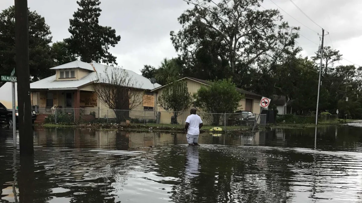
In the coastal community of Brunswick, Georgia, Semona Holmes looks out at her garden—a lush oasis of fruit trees and blooming flowers—and sees a potential vessel for disaster. When the rains intensify or the tides swell, her street transforms into a waterway. While neighbors might see an inconvenience, Holmes sees a chemical delivery system. Living just half a mile from a decommissioned pesticide plant, now a designated federal Superfund site, she fears that the floodwaters are not merely rainwater, but a toxic slurry of legacy pollutants disturbed by a changing climate.
Holmes’ story is not an outlier; it is the lived reality for thousands of residents in Glynn County, where the ghosts of an industrial past linger in the soil, the sediment, and the rising tide.
The Intersection of Industrial Legacy and Climate Change
The crisis in Brunswick sits at a perilous intersection: the failure to fully remediate industrial contamination and the accelerating threats of climate change. For decades, the region served as a hub for chemical manufacturing and industrial processing. When these facilities closed, they left behind a complex web of toxic legacies—heavy metals, volatile organic compounds, and pesticides—that the Environmental Protection Agency (EPA) eventually categorized under the Superfund program.
However, the containment strategies designed for these sites were largely formulated decades ago, based on historical climate data that did not account for the rapid sea-level rise and the increasing frequency of extreme weather events currently battering the Georgia coast. As storm surges push inland and nuisance flooding becomes the new normal, the physical caps and containment structures intended to seal off hazardous materials are facing unprecedented pressure.
A New Scientific Frontier: The Superfund Research Center
Recognizing that the threat is evolving, a coalition of six prestigious academic institutions has launched a massive, $15 million study funded by the National Institute of Environmental Health Sciences (NIEHS). This initiative marks the establishment of Georgia’s first-ever Superfund research center, a five-year project aimed at unraveling the public health mystery of Glynn County.
The research team, which includes experts from Emory University, the University of Georgia, Georgia Tech, Morehouse School of Medicine, Spelman College, and Texas Tech University, has set its sights on four major toxic sites in the region.
The Two-Pronged Strategy
According to Dr. Noah Scovronick, a professor of public health at Emory University, the project’s objectives are distinct yet interconnected:
- Retrospective Analysis: To quantify the historical health impacts of chemical exposures on the local population.
- Prospective Mitigation: To develop models that identify how future climate events—such as hurricanes and storm surges—might breach containment, and to recommend strategies to reduce future exposure.
The center will conduct extensive environmental sampling to map how pollutants migrate from industrial footprints into residential areas during flood events. This data will be instrumental in determining whether current remediation efforts are truly "resilient" to the climate realities of the next several decades.
Chronology of a Contaminated Coast
The industrial history of Glynn County is long and checkered. The following timeline outlines the evolution of this environmental crisis:
- Mid-20th Century: A period of unchecked industrial expansion occurs in Brunswick, with multiple chemical and pesticide manufacturing plants operating without the stringent environmental regulations of the modern era.
- Late 20th Century: The EPA begins the Superfund designation process as the extent of groundwater and soil contamination becomes impossible to ignore. Several sites in Glynn County are placed on the National Priorities List.
- Early 2000s: Remediation efforts begin. These typically involve "capping" sites with layers of clay or synthetic liners to prevent toxic leaching and the implementation of groundwater monitoring wells.
- 2010–2025: Local residents, including Semona Holmes, report an increase in tidal flooding and storm-driven inundation. Concerns grow regarding the integrity of the protective caps.
- 2026: The NIEHS awards $15 million to a consortium of six universities to launch a dedicated research center, marking the first time such a comprehensive, multi-disciplinary approach has been applied to this specific region.
Supporting Data: The Hidden Health Burden
The anxiety felt by residents like Holmes is backed by a growing body of academic concern. While the EPA has performed remedial work, critics argue that the criteria for "cleanup" often prioritize containing the most egregious surface contamination while leaving deeper, more insidious long-term risks unaddressed.
The Exposure Pathway
The researchers are particularly interested in the "exposure pathway." In a standard environment, pollutants stay buried. In a flood-prone, low-lying coastal zone, the water table rises, effectively "flushing" contaminated soil and groundwater into the surface environment. This is particularly concerning for children, who are more susceptible to the developmental effects of toxins.
Schools in the area, often built on reclaimed or adjacent land, have become a focal point for the research team. If children are playing on soil that has been re-contaminated by a flood-borne breach of a nearby industrial site, the health implications could be generational.
Official Responses and Corporate Accountability
The role of the private sector in this saga remains a flashpoint for local activism. Many of the companies that operated the now-defunct plants have undergone mergers, acquisitions, or restructurings, often complicating the search for legal and financial accountability.
Federal agencies like the EPA maintain that their remediation projects meet current regulatory standards. However, the scientific community is beginning to argue that "regulatory standards" are falling behind the "climatic reality."
In public meetings, community leaders have pushed for more than just data collection. They are demanding:
- Enhanced Containment: Replacing passive caps with more robust, climate-resilient infrastructure.
- Transparency: Open-access data portals that allow residents to see real-time testing results of soil and water in their neighborhoods.
- Health Surveillance: Long-term medical monitoring for residents living in the immediate vicinity of the four targeted Superfund sites.
Implications: A Call for Environmental Justice
The implications of this research extend far beyond the borders of Glynn County. Brunswick serves as a "canary in the coal mine" for hundreds of other coastal communities across the United States. Thousands of former industrial sites exist in vulnerable, low-lying coastal areas. If the Georgia study reveals that current containment strategies are failing due to climate-driven flooding, it could force a massive, multi-billion-dollar federal reassessment of how we protect the public from the industrial past.
For Semona Holmes, the $15 million study is a start, but it is not the finish line. "It shows that you care about humanity," she says of the scientific intervention. "And that you are able to acknowledge that, ‘Yeah, by our actions, we have possibly contaminated an entire county.’"
However, acknowledgment is only the first step. The true test of this research project will be whether it leads to tangible improvements in the physical safety of the environment. As the tide continues to rise, the window to act—to reinforce these sites and protect vulnerable populations—is narrowing.
"There has to be continued action," Holmes insists. Her plea serves as a sobering reminder that for the residents of Brunswick, this is not a theoretical debate about climate science; it is a daily struggle for the health of their children, the safety of their homes, and the right to live without the fear of what the next high tide will bring to their doorstep.
About the Author